‘Tis the season to spring into action
The Great Smoky Mountains and all their scenic vistas are literally just down the road, so grab your hiking boots and hit the trails! Don’t worry, there are plenty of short and moderate hikes that make for great day trips, so you won’t need to worry about packing a tent. However, always remember to bring a map, water and a flashlight, and be sure to tell someone where you’re going and when you expect to return. The following information comes from hikinginthesmokys.com, where you can find more detailed information about each trail.
Chimney Tops (roundtrip: 4 miles, elevation gain: 1350 ft, difficulty: moderate) “The trailhead for Chimney Tops is located roughly 6.7 miles south of the Sugarlands Visitor Center (between the lower tunnel and “the loop” on Newfound Gap Road).”
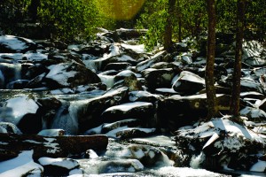
Mt. LeConte via Alum Cave Trail (roundtrip: 11 miles, elevation gain: 2763 ft, difficulty: strenuous) “From the Sugarlands Visitor Center near Gatlinburg, drive 8.7 miles south along Newfound Gap Road to the Alum Cave Trailhead. The parking lot will be on your left. Due to the popularity of the Alum Cave Trail, there are two parking lots for this trailhead. To ensure a spot, you may want to get here early during peak season, as well as any nice weekend throughout the year.”
Schoolhouse Gap (roundtrip: 3.8 miles, elevation gain: 513 ft, difficulty: easy) “From the Townsend “Y” intersection, drive west on Laurel Creek Road towards Cades Cove. The parking area for the Schoolhouse Gap Trail will be on your right, 3.7 miles from the Townsend “Y” intersection.”
Cucumber Gap Loop (roundtrip: 5.6 miles, elevation gain: 830 ft, difficulty: moderate) “From the Sugarlands Visitor Center near Gatlinburg, drive 4.9 miles on Little River Road to the Elkmont Campground turnoff on your left. After turning into Elkmont, drive 1.4 miles until you reach the campground. Instead of proceeding into the campground, you will need to turn left to reach the parking area for the Little River Trail. The parking lot for the Cucumber Gap Loop Trail (via the Little River Trail) will be 0.6 miles from the campground.”
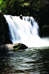
Abrams Falls (roundtrip: 5 miles, elevation gain: 136 ft, difficulty: moderate) “The hike to Abrams Falls begins from a field at stop number ten on the Cades Cove Loop Road. To reach the Abrams Falls trailhead, drive five miles on the Cades Cove Loop. After crossing Abrams Creek, turn right on a gravel road which runs through a grassy field. Park at the back of the field where there are signs and a wooden bridge that mark the beginning of the trail.”
Gregory Bald via Gregory Bald Trail (roundtrip: 8.8 miles, elevation gain: 2300 ft, difficulty: strenuous) “From the Townsend “Y” intersection, go west on Laurel Creek Road towards Cades Cove. To reach the Gregory Bald Trail, drive 7.5 miles into Cades Cove, pass the main parking lot and enter the one-way loop. At 13.2 miles from Townsend the loop road makes a sharp left. At this junction, continue by driving straight onto Forge Creek Road. After driving another 2.2 miles you’ll reach the one-way Parson Branch Road, which forks off to the right (you’ll pass the Gregory Ridge Trailhead here). Turn right onto the Parsons Branch Road, and drive 3.3 miles until reaching the Gregory Bald Trailhead at Sams Gap.”
Observation Tower at Look Rock on the Foothills Parkway Simply drive toward Townsend and follow the signs to Look Rock. There is a marked parking lot and a path to the trail. The trail leading up to the observation tower is about a half mile long and is fairly easy. This is a great hike if you are just looking for a way to appreciate the Smokies but only have an afternoon to spare.
If you’ve got a little cash to burn, two awesome ways to enjoy the springtime weather both start where the alphabet ends.
Ziplining: While it’s great to admire the blue skies and green trees from the ground, it’s even better 100 feet in the air going 40 mph. Check out Wahoo! Ziplines in Sevierville for a unique experience. Pricing starts at $89 + tax. Go to http://www.wahoozip.com/ to learn more. (Coupon here! http://smokymountainnavigator.com/index.asp?mid=71)
Zorbing: This activity is for those of you who envied your pet gerbils as they had the times of their lives rolling around in that giant ball of theirs.
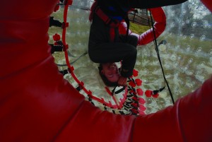
Zorbing, or globe riding, basically involves the participant(s) getting inside a large, plastic ball and rolling down a hill. You can opt to be strapped in and bounce around upside down and on your side, or you can ditch the restraints and have them add water instead so you can slide around inside the ball as it bounces down the hill. It’s noteworthy that the location at Pigeon Forge is one of just three Zorb locations around the world. Zydro rides (with water) start at $35 for one person, but get cheaper as you add people. Zorbit rides (without water) are $40 per person. They do offer combo packages. Check it out at http://zorb.com/zorb/welcome-to-zorb/
While nature is typically free to enjoy, the gear sometimes required can get a little pricey, or you may not feel savvy enough to go wandering the Smokies with your best city-pal. Unfortunately, that tends to discourage a lot of people from enjoying the wonderful nature that surrounds us. But have no fear because Mountain Challenge offers super-cheap adventures almost weekly for students to have the chance to get outside and have some fun. Even better, you can earn credit hours!
April 1: Open Tower @ 1 pm – $3
April 14: Open Tower @ 9 am – $3
April 21: Hiking @ 9 am – $3
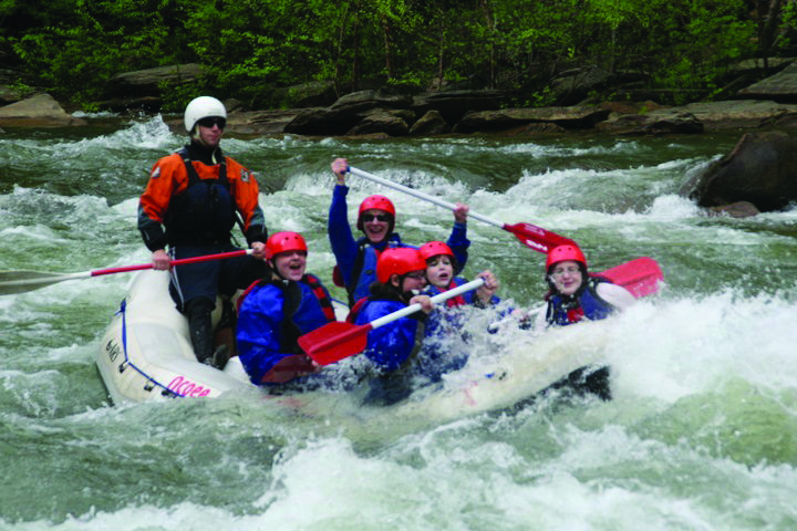
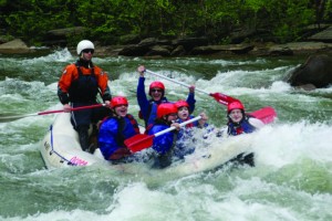
April 28: Whitewater Rafting on the Ocoee @ 9 am – $32
May 5: Open Tower @ 9 am – $3 More info available at mtnchallenge.com
Perhaps the most famous campsite known to MC students, campsite 18 is an easy-access site tucked away in the park. Far enough away from civilization that you can have a campfire and see some beautiful stars at night, but close enough that you might still get cell phone reception in case of emergency. Find directions to the campsite here: http://www.hikinginthe smokys.com/ west_prong.htm More information on backcountry camping rules and regulations can be found at nps.gov

